
Following the Beep: Cat Tracking and Conservation in Queen Elizabeth National Park
In a world of satellite imagery and real-time wildlife data, there is something unexpectedly thrilling about old-fashioned fieldwork. Sitting in the back of a safari vehicle in the early morning, windows down, antenna raised, listening for a faint beep—this is how some of the most important conservation work still happens today.
Telemetry tracking big cats in Uganda felt like stepping back into the roots of wildlife research. It wasn’t instant. It wasn’t guaranteed. And that uncertainty made every moment more exciting.
Queen Elizabeth National Park: A Landscape Built for Predators
Queen Elizabeth National Park is one of Uganda’s most diverse protected areas. Stretching from open savanna to wetlands, crater lakes, and forested corridors, it supports an incredible density of wildlife—and one of the country’s most important populations of lions and leopards.
This diversity is also what makes conservation here so complex. Big cats move constantly in response to prey availability, water levels, seasonal flooding, and human activity along park boundaries. Understanding those movements is essential for protecting both wildlife and surrounding communities.
How Telemetry Tracking Works
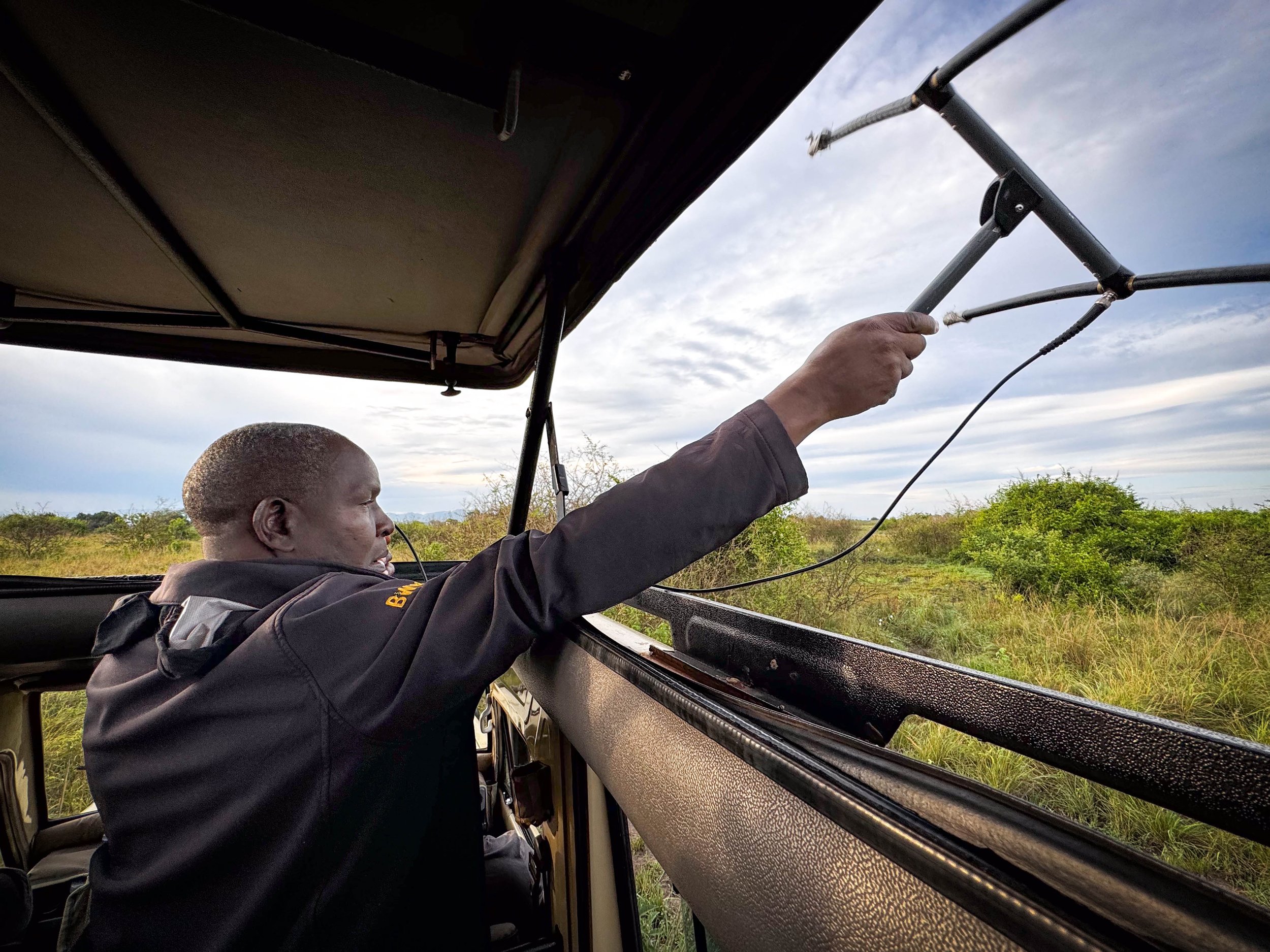
Our day began before sunrise with a local guide carrying telemetry equipment—a handheld receiver connected to an antenna, tuned to the radio frequencies of collared cats. As we drove slowly through the park, the vehicle fell quiet. Everyone listened.
The signal came through as a steady pulse. Soft at first. Then louder. Then unmistakable.
Telemetry tracking allows researchers and park managers to:
Monitor the movements of individual lions and leopards
Identify key hunting and resting areas
Reduce human–wildlife conflict near park edges
Inform long-term management and conservation strategies
Unlike modern GPS tracking, telemetry requires patience. It requires presence. And it turns tracking into a shared experience rather than a screen-based one.
The Power of Anticipation
There was something deeply engaging about the process. Each change in signal strength brought a rush of anticipation. Would the cat be nearby? Would it still be resting? Would it be visible at all?
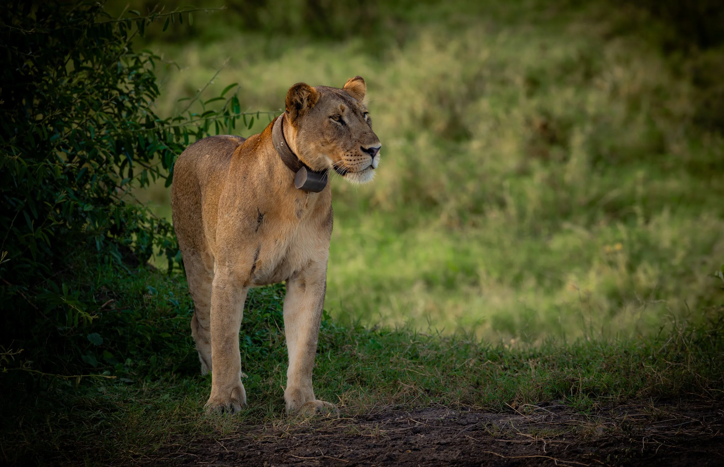
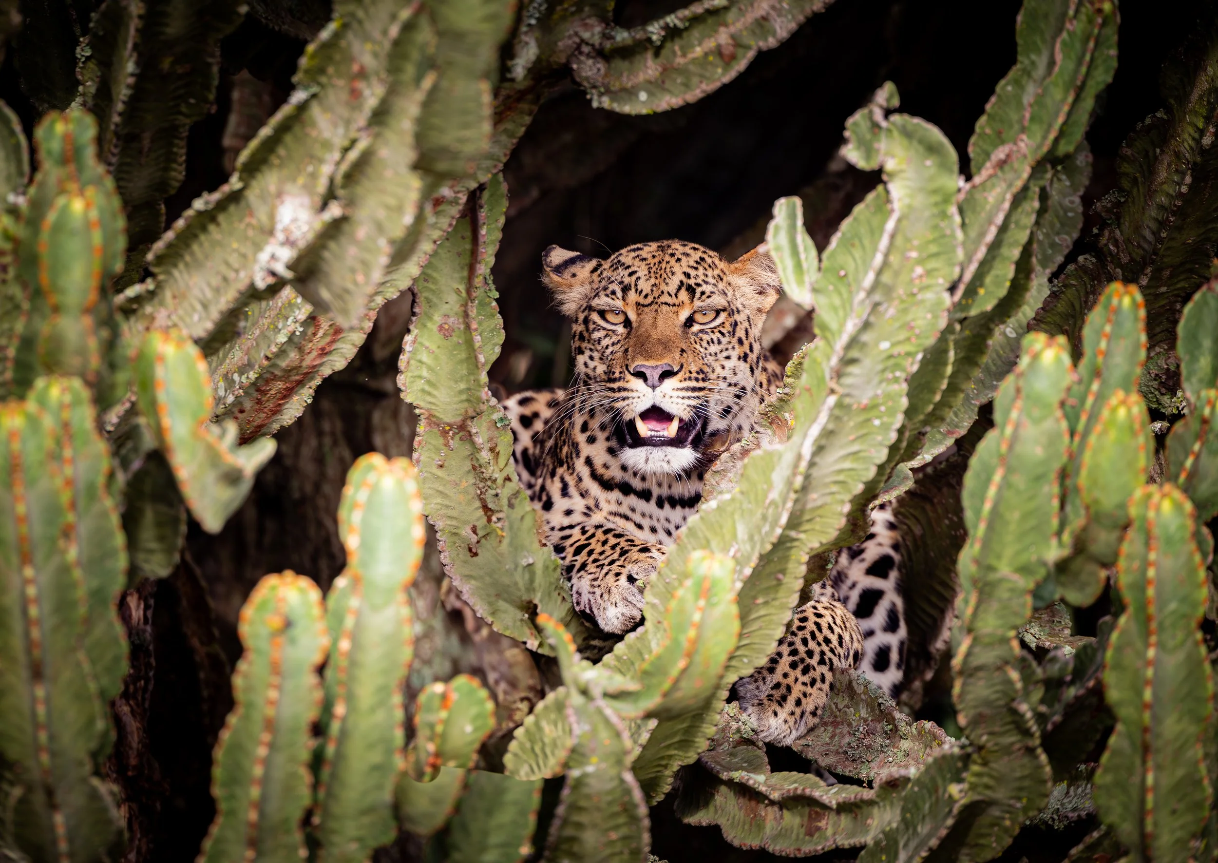
That anticipation paid off. First, several lions appeared, stretched out in the warm glow of early light, their position aligning exactly with the data the telemetry suggested. Later, the signal led us to a leopard draped effortlessly in a tree, almost invisible until your eyes adjusted.
These were not chance sightings. They were moments made possible by long-term research, careful monitoring, and collaboration with local experts who know this landscape intimately.
Why Telemetry Still Matters
Telemetry may feel old-fashioned, but it remains one of the most effective tools for conservation in places like Queen Elizabeth National Park. It bridges the gap between science and lived experience, allowing guides, researchers, and visitors to engage directly with the process of protecting wildlife.
Just as importantly, working with local guides ensures that conservation supports livelihoods, builds expertise within communities, and creates shared responsibility for protecting these animals.
Contributing to Conservation
Participating in telemetry tracking changes how you see wildlife encounters. You’re not just witnessing lions and leopards, you’re seeing the invisible work that helps keep them on the landscape.
It makes conservation tangible. A portion of the money you pay to participate in a cat tracking experience goes directly to the local communities. It turns data into stories. And it reminds you that protecting wildlife often starts with listening, sometimes quite literally, for a quiet beep in the morning air.
Our Uganda expedition includes opportunities to learn from local guides and witness conservation tools like telemetry tracking in action, offering a deeper understanding of how science and stewardship come together in the field.